

Streetcar 503 in Toronto links York St at King St West North Side and Bingham Loop. The route is 10.2 km long with 40 stops, and the official schedule from the Toronto Transit Commission puts the full trip at about 52 minutes. On a weekday it runs 153 trips in one direction, and 121 on a weekend day.
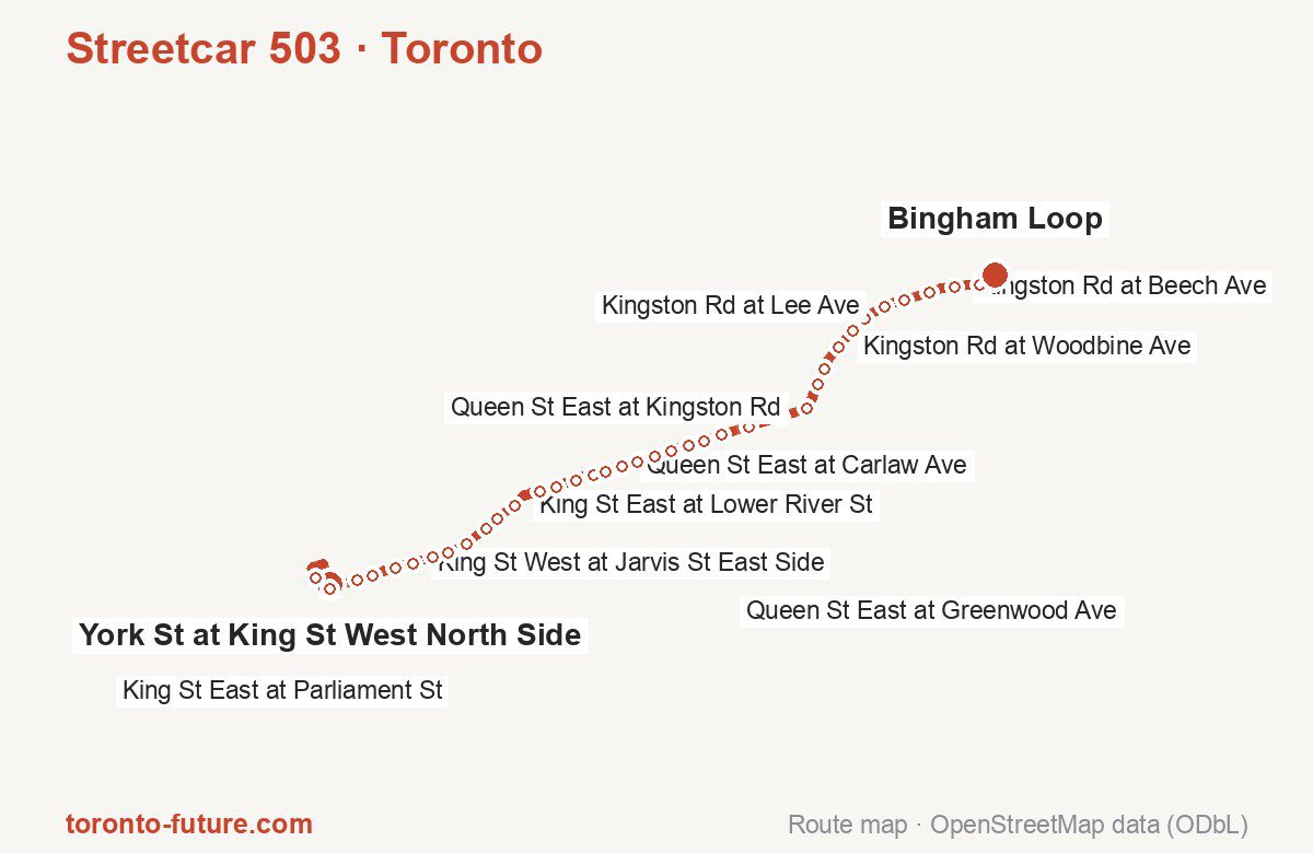
Route at a glance
| Mode | Streetcar |
|---|---|
| Route number | 503 |
| City | Toronto |
| Transit authority | the Toronto Transit Commission (TTC) |
| Start → end | York St at King St West North Side → Bingham Loop |
| End → start | Bingham Loop → York St at King St West North Side |
| Route length | 10.2 km / 9.2 km in the opposite direction |
| Number of stops | 40 / 38 in the opposite direction |
| Travel time | about 52 minutes |
| Trips per day | 153 on weekdays, 121 on weekends one way (150 on weekdays → York St at King St West North Side) |
| Frequency | peak 3–10 · midday 6–10 · weekend 10–20 |
| First / last trip from «York St at King St West North Side» | 00:06 / 23:56 |
| First / last trip from «Bingham Loop» | 00:07 / 23:57 |
| Fare | 3.35 $ |
| Updated | August 22, 2026 |
Route of Streetcar 503
Outbound: York St at King St West North Side → Bingham Loop
This direction has 40 stops and runs 10.2 km. The route passes University Ave at Adelaide St West, King St East at Sackville St, Queen St East at Pape Ave, Kingston Rd at Dixon Ave. Below is the full list with the distance from the first stop.
| No. | Stop | From start | Note |
|---|---|---|---|
| 1 | York St at King St West North Side | 0.8 km | Terminus |
| 2 | University Ave at Adelaide St West | 0.6 km | |
| 3 | King St West at York St – St Andrew Station | 0.0 km | |
| 4 | King St West at Bay St East Side | 1.1 km | |
| 5 | King St West at Yonge St East Side – King Station | 1.4 km | |
| 6 | King St East at Church St East Side | 1.6 km | |
| 7 | King St West at Jarvis St East Side | 1.8 km | |
| 8 | King St East at Sherbourne St | 2.1 km | |
| 9 | King St East at Ontario St | 2.3 km | |
| 10 | King St East at Parliament St | 2.6 km | |
| 11 | King St East at Sackville St | 2.9 km | |
| 12 | King St East at Sumach St | 3.0 km | |
| 13 | King St East at Lower River St | 3.3 km | |
| 14 | Queen St East at Carroll St | 3.6 km | |
| 15 | Queen St East at Broadview Ave | 3.9 km | |
| 16 | Queen St East at Saulter St East Side | 4.1 km | |
| 17 | Queen St East at Empire Ave | 4.3 km | |
| 18 | Queen St East at Logan Ave | 4.5 km | |
| 19 | Queen St East at Carlaw Ave | 4.7 km | |
| 20 | Queen St East at Pape Ave | 4.9 km | |
| 21 | Queen St East at Caroline Ave | 5.1 km | |
| 22 | Queen St East at Jones Ave | 5.3 km | |
| 23 | Queen St East at Leslie St | 5.5 km | |
| 24 | Queen St East at Alton Ave | 5.7 km | |
| 25 | Queen St East at Greenwood Ave | 5.9 km | |
| 26 | Queen St East at Woodfield Rd | 6.3 km | |
| 27 | Queen St East at Emdaabiimok Ave | 6.7 km | |
| 28 | Queen St East at Kingston Rd | 7.0 km | |
| 29 | Kingston Rd at Dixon Ave | 7.3 km | |
| 30 | Kingston Rd at Columbine Ave | 7.5 km | |
| 31 | Kingston Rd at Woodbine Ave | 7.8 km | |
| 32 | Kingston Rd at Elmer Ave | 8.1 km | |
| 33 | Kingston Rd at Waverley Rd | 8.3 km | |
| 34 | Kingston Rd at Lee Ave | 8.6 km | |
| 35 | Kingston Rd at Southwood Dr | 8.8 km | |
| 36 | Kingston Rd at Glen Manor Dr | 9.1 km | |
| 37 | Kingston Rd at Beech Ave | 9.4 km | |
| 38 | Kingston Rd at Scarborough Rd | 9.7 km | |
| 39 | Kingston Rd at Bingham Ave | 9.9 km | |
| 40 | Bingham Loop | 10.2 km | Terminus |
Inbound: Bingham Loop → York St at King St West North Side
This direction has 38 stops and runs 9.3 km. The route passes Bingham Ave at Kingston Rd, Kingston Rd at Columbine Ave, Queen St East at Brooklyn Ave, King St East at Sumach St. Below is the full list with the distance from the first stop.
| No. | Stop | From start | Note |
|---|---|---|---|
| 1 | Bingham Loop | 0.1 km | Terminus |
| 2 | Bingham Ave at Kingston Rd | 0.2 km | |
| 3 | Kingston Rd at Scarborough Rd | 0.3 km | |
| 4 | Kingston Rd at Beech Ave | 0.6 km | |
| 5 | Kingston Rd at Glen Manor Dr | 0.9 km | |
| 6 | Kingston Rd at Main St | 1.2 km | |
| 7 | Kingston Rd at Lee Ave | 1.5 km | |
| 8 | Kingston Rd at Brookside Dr | 1.8 km | |
| 9 | Kingston Rd at Elmer Ave | 2.0 km | |
| 10 | Kingston Rd at Woodbine Ave | 2.2 km | |
| 11 | Kingston Rd at Columbine Ave | 2.6 km | |
| 12 | Kingston Rd at Dundas St East | 2.7 km | |
| 13 | Kingston Rd at Queen St East | 3.0 km | |
| 14 | Queen St East at Coxwell Ave | 3.4 km | |
| 15 | Queen St East at Woodfield Rd | 3.8 km | |
| 16 | Queen St East at Greenwood Ave | 4.1 km | |
| 17 | Queen St East at Alton Ave | 4.3 km | |
| 18 | Queen St East at Leslie St | 4.5 km | |
| 19 | Queen St East at Jones Ave | 4.8 km | |
| 20 | Queen St East at Brooklyn Ave | 5.0 km | |
| 21 | Queen St East at Pape Ave | 5.2 km | |
| 22 | Queen St East at Carlaw Ave | 5.4 km | |
| 23 | Queen St East at Logan Ave | 5.6 km | |
| 24 | Queen St East at Empire Ave | 5.8 km | |
| 25 | Queen St East at Boulton Ave | 5.9 km | |
| 26 | Queen St East at Broadview Ave | 6.2 km | |
| 27 | Queen St East at Carroll St | 6.4 km | |
| 28 | King St East at River St | 6.8 km | |
| 29 | King St East at Sumach St | 7.0 km | |
| 30 | King St East at Sackville St | 7.2 km | |
| 31 | King St East at Parliament St | 7.5 km | |
| 32 | King St East at Ontario St | 7.8 km | |
| 33 | King St East at Sherbourne St | 7.9 km | |
| 34 | King St West at Jarvis St West Side | 8.3 km | |
| 35 | King St East at Church St West Side | 8.5 km | |
| 36 | King St West at Yonge St West Side – King Station | 8.8 km | |
| 37 | King St West at Bay St West Side | 8.9 km | |
| 38 | York St at King St West North Side | 9.2 km | Terminus |
Schedule and frequency
According to the official schedule from the Toronto Transit Commission, the route runs 153 trips in one direction on a weekday, and 121 on a weekend day.
| Direction | Weekdays | Weekends and holidays |
|---|---|---|
| From «York St at King St West North Side» | 00:06 — 23:56 | 00:03 — 23:53 |
| From «Bingham Loop» | 00:07 — 23:57 | 00:08 — 23:58 |
Frequency calculated from the departure table: in the morning peak cars run every 3–10 minutes, most often every 6; midday every 6–10 minutes; in the afternoon peak every 6–12; on weekends every 10–20 minutes.
Fare and payment
A single ride costs 3.35 $. The same fare applies to streetcars, buses and the subway in Toronto.
A cash fare is $3.35 and covers one ride only. Paying with a PRESTO card, debit or credit card costs $3.30 and includes two hours of unlimited transfers. A day pass is $13.50, a monthly adult pass $156.00. Transfers within 120 minutes are free. The two-hour transfer applies only to fares paid by card; a cash fare covers a single ride. An unlimited monthly pass costs $156.00.
Frequently asked questions
How much does a ride on streetcar 503 cost?
3.35 $ for a single ride.
When do the first and last trips run?
From York St at King St West North Side the first is at 00:06 and the last at 23:56. From Bingham Loop they are 00:07 and 23:57.
How long does the trip from York St at King St West North Side to Bingham Loop take?
About 52 minutes end to end — the median of full trips in the official schedule.
How many stops does the route have?
40 outbound and 38 inbound according to the official GTFS feed. The two lists do not match exactly.
Does streetcar 503 run on weekends?
Yes. On weekends and holidays there are 121 trips in one direction, running from York St at King St West North Side between 00:03 and 23:53.
Every route number with its termini, operating hours and travel time is collected in the Toronto streetcars overview.
Data current as of August 22, 2026. Schedule and termini — the Toronto Transit Commission (TTC). Fares — Toronto Transit Commission, Fares & passes. Stop list, schedule and route geometry come from the official GTFS feed (City of Toronto Open Data).